Bluesky’s aerial thermal surveys helps Enfield identify illegal dwellings
Leicestershire, 28 September 2016 - Enfield Council is using aerial maps from Bluesky to identify outbuildings used illegally for residential purposes. The problem of ‘beds in sheds’ is growing nationally, with nearly 40,000 inspections across the UK resulting in over 3,000 landlords facing further enforcement action or prosecution since 2011. Earlier this year, the Department for Communities and Local Government (DCLG) announced a £5 million cash boost for Councils to tackle rogue landlords, with Enfield Council receiving £360,000 of funding.
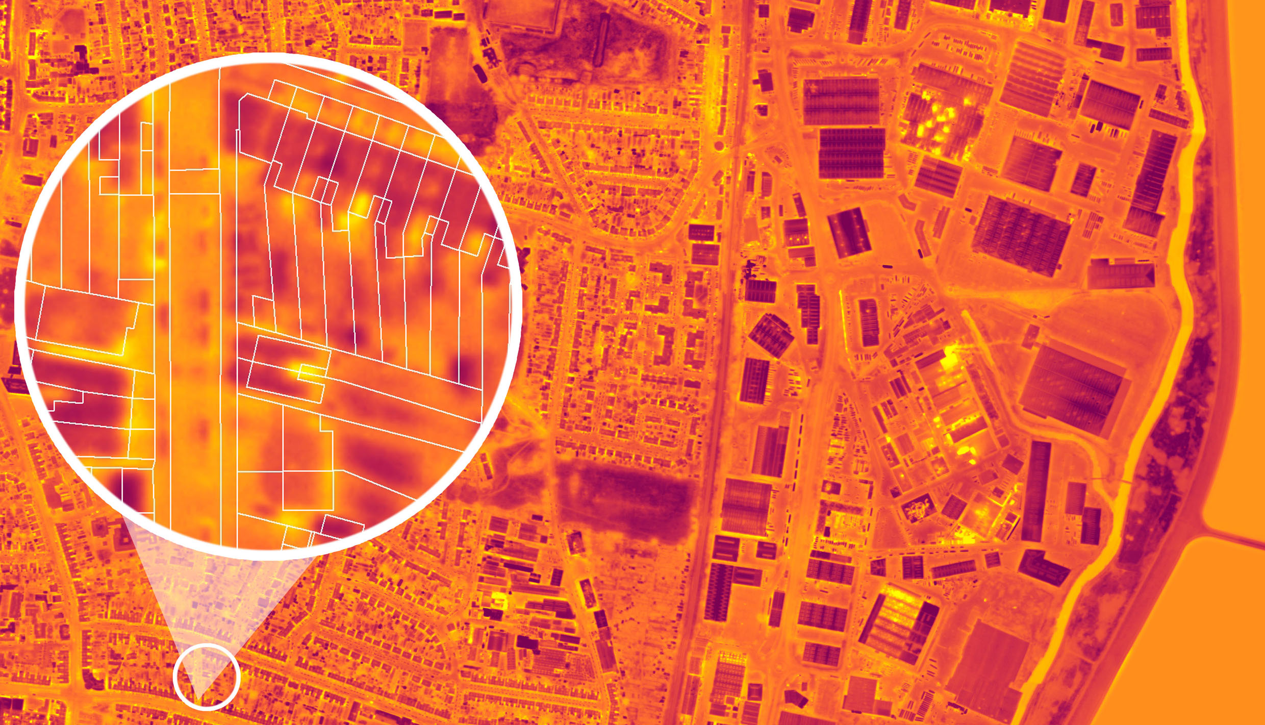
Enfield used part of this funding to commission Bluesky to fly the streets of Enfield with a special thermal camera that can capture heat loss values for individual buildings across an entire Borough in just one evening. The resulting thermal maps, when combined with aerial photographs, are helping Enfield Council to identify properties with unusual or unexpected heat signatures that may be being used for living accommodation or other unpermitted purposes.
“The thermal imagery, when overlaid with the photography, allows us to identify and target specific areas in the borough where we know there is potentially a problem with rogue landlords,” commented Rob Oles, Pollution Control and Planning Enforcement Manager at Enfield Council. “This provides us with key intelligence that we would not otherwise have, and allows us to target our investigative resources more effectively.”
The unscrupulous actions of rogue landlords see structures such as garages and outbuildings being rented out, and conditions can vary, with people living with no electricity, running water or toilet. However, it is not only a lack of facilities that is a problem. Living in structures that are not supposed to be used as accommodation poses a fire risk. In a three year period, London Fire reported 235 fires in buildings in London that should not have been residentially occupied, resulting in four deaths and 45 serious injuries. Poor quality, overcrowded and dangerous accommodation can also have a ripple effect with wider problems, such as noise, sanitation, council tax and benefit fraud, and anti-social behaviour, impacting the wider community.
The Bluesky data, including laser mapped LiDAR models, will also be used to support other initiatives by Enfield Council, including identification of other planning infringements, such as unauthorised developments or change of use, and as evidence to pursue enforcement actions. The Council is also planning to use to the data for identification of correlations between areas of pre 19th and 20th Century housing and heat loss to support fuel poverty and energy efficiency projects.
CONTACTS:
Robert Peel – Editorial Contact
The Marketing Edge
Tel: +44 (0) 1666 823306
robert@market-it.co.uk
Laura Eddy – Marketing Co-ordinator
Bluesky International
Tel: +44 (0) 1530 518518
laura.eddy@bluesky-world.com
www.bluesky-world.com
This press release was distributed by ResponseSource Press Release Wire on behalf of The Marketing Edge in the following categories: Public Sector, Third Sector & Legal, Manufacturing, Engineering & Energy, Construction & Property, for more information visit https://pressreleasewire.responsesource.com/about.